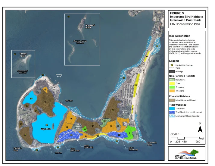
Davison Environmental utilizes the latest mapping technology to both analyze and illustrate natural resource information. Natural resource data is collected in the field using Trimble© GPS technology with sub-meter accuracy. This data is imported to and analyzed using Esri© software for incorporation into a variety of GIS-based map products.